SEASTORM-2
Unraveling the signals of sea level and storminess of the past millennium (southern North Sea; SEASTORM)
Summary:
The overarching objective of SEASTORM is to unravel the signals of local to regional sea level and storminess in the coastal sedimentary archives of the southeastern North Sea region. The main hypothesis to test is that existing proxy-based sea-level reconstructions bear a so far underestimated storm-climate component. Similarly, we expect that the storm climate will be also critical in future sea-level rise under the influence of global warming. The proposed work builds on the results the first funding phase. In detail, we want to address the following objectives:
- Unlocking the sea level and climate signals provided by the salt-marsh archives at the southeastern North Sea coastal region, and gaining new data series on relative sea level and storminess with a focus on the past 100 years;
- Evaluating the impact of shifts in local storm climate onto proxy-based sea-level reconstructions;
- Validating the proxy-based data series of storminess, based on observations and integrative comparison of the respective modes of variability and drivers for selected periods during the past millennium;
- Quantifying the deterministic part of extreme storm-flood variability in the German Bight with respect to relevant forcing mechanisms;
- Investigating the response of modern salt-marsh environments to regional sea level and climate change.
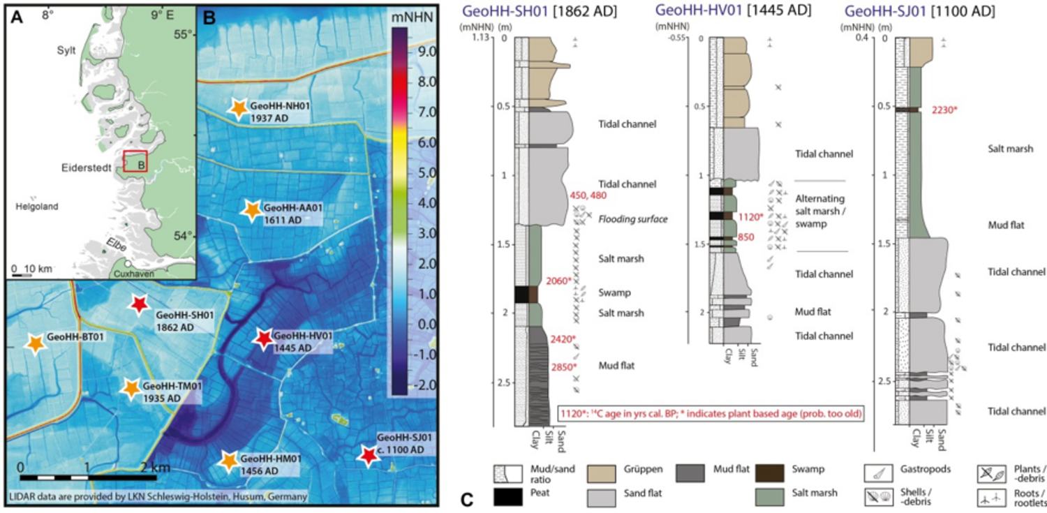
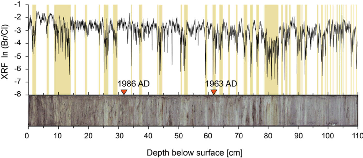
The project targets will be realized by an integrated approach, combining sedimentological, geochemical, and micropaleontological methods as well as climate modeling experiments. Both proxy reconstructions and modeling will focus on the same time intervals and key targets. This strategy will allow for a critical validation of proxy and model results through the course of the project. Aside from general proxy-based sea-level reconstructions for the Holocene on centennial- to millennial-scale resolution and evaluation of historical weather information there exists no attempt to reconstruct the forcing mechanisms and coastal impacts of sea-level variability and storminess of the southern North Sea region on a yearly to multi-decadal resolution by linking proxy data with climate modeling information.
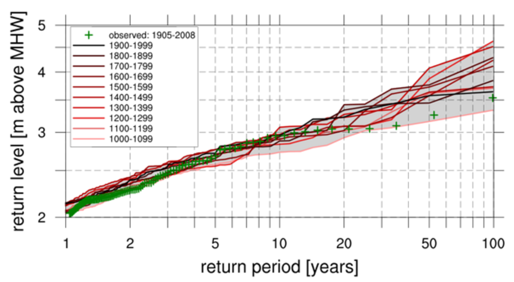
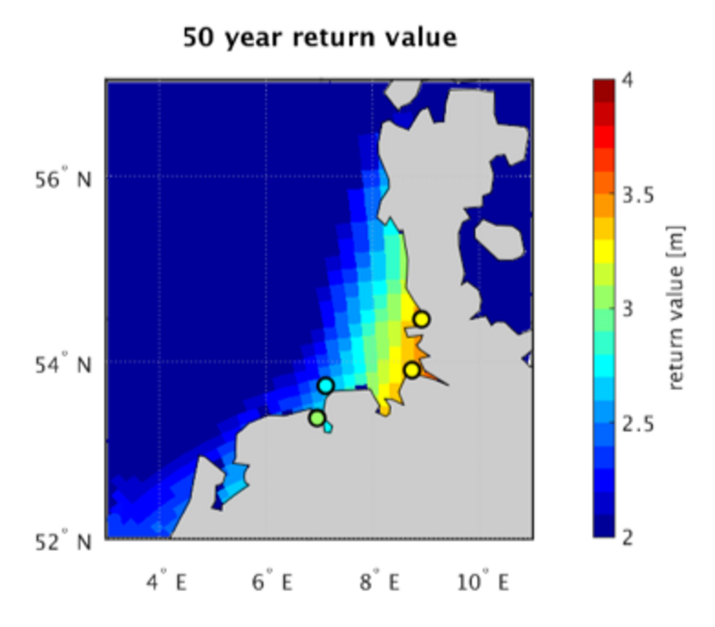
Additionally, we aim on extending the model simulations into the future to identify potential changes in storm-surge variability under global warming. The high variability in extremes has shown that large ensembles are necessary to estimate changes in future storm-flood statistics. Previous studies that rely on short data or small ensembles to estimate future storm-flood statistics miss an important factor as they do not account for the large variability in sea-level extremes and thus cannot adequately estimate changes in the top end of the distribution.
Publications of the SEASTORM project: