SATELLITE
A stochastic eStimATe of sEa Level contribution from gLaciers and Ice caps using satellite remoTe sEnsing (SATELLITE)
Glaciers and ice caps outside the large ice sheets store less than 1% of the global ice masses (Vaughan et al. 2013). Nevertheless, their mass loss has been a major cause of sea level rise during the last century (Gregory et al. 2013). Glaciers have contributed to sea level rise during most of the 20th century with relatively constant mass loss rates (e.g. Cogley 2009; Gregory et al. 2013; Marzeion et al. 2012). Marzeion et al. (2014) attribute the mass loss during the first decades of the 20th century as driven by ice loss in lower altitudes, when glacier retreated from their 19th century maxima extent. Marzeion et al. (2012) quantify the ice mass loss in the period 1902-2009 to 114±5 mm sea-level equivalent (SLE). Using scenarios of the Coupled Model Intercomparison Project phase 5 (CMIP5) ensemble runs, they project a mass loss of 148±35 mm SLE (RCP26) and 217±47 mm SLE for the RCP85 scenario over the 21st century. The ice mass loss was projected to peak around 2040-2050 or 2070-2100 depending on the scenario used for forcing. Marzeion et al. (2014) report that only 25±35% of the global glacier mass loss during the period 1851-2010 can be attributed to anthropogenic forcing, while 69±24% of the signal in the observation 1991-2010 can be attributed to this influence.
So far, only very few studies exist that attempted a global estimate of glacier mass changes using one observation period and one methodology or database. Gardner et al. (2013) provide an estimate for the period 2003-09 combining data from the ICESat and GRACE mission. They report a value of -259±28 Gt/yr as mass budget corresponding to 29±13% of the observed sea level rise or 0.71 ± 0.08 mm SLE/yr.
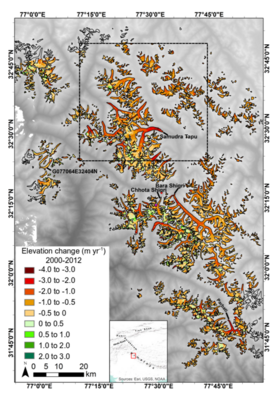
The project aims at deriving a stochastic global sampling for ice volume and mass loss of glaciers and ice caps based on repeat satellite observations. For this purpose we will develop a respective sampling strategy. We propose two observation intervals: a period 2000-2012 between 56°S and 60°N and a second interval covering 2012 to 2014 or later (globally) in order to quantify potential changes in ice volume/mass loss rates.
Geodetic glacier mass balances provided for on a statistical representative sample of glaciers and ice caps will enable us to quantitatively compare changes and change rates in different regions of the world using the same methodology. We will also tackle the question on how comprehensive such sampling needs to be. We will mainly base our analysis on data from the German satellite mission TanDEM-X and integrate it with observations and data products from other sources (like SRTM, ASTER, Landsat, ICESat, WGMS records, field and airborne measurements). The German TanDEM-X satellite mission operated since 2010 provides a unique database with its bi-static satellite configuration.
The SATELLITE project is also a member of the Focusgroup Cryosphere and Sea Level (FCS).

