SEASchange
Holocene sea-level changes in Southeast Asia (SEASchange)
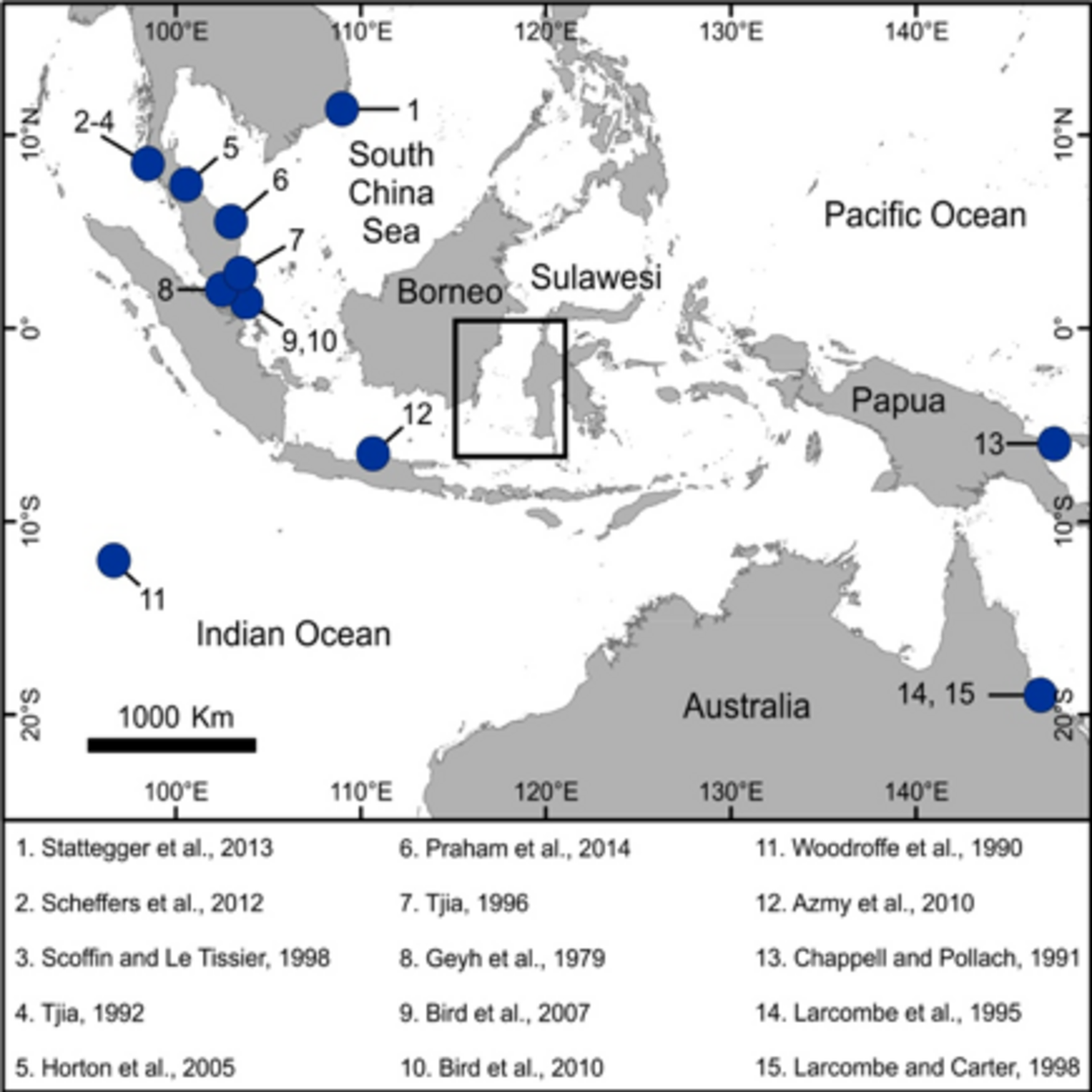
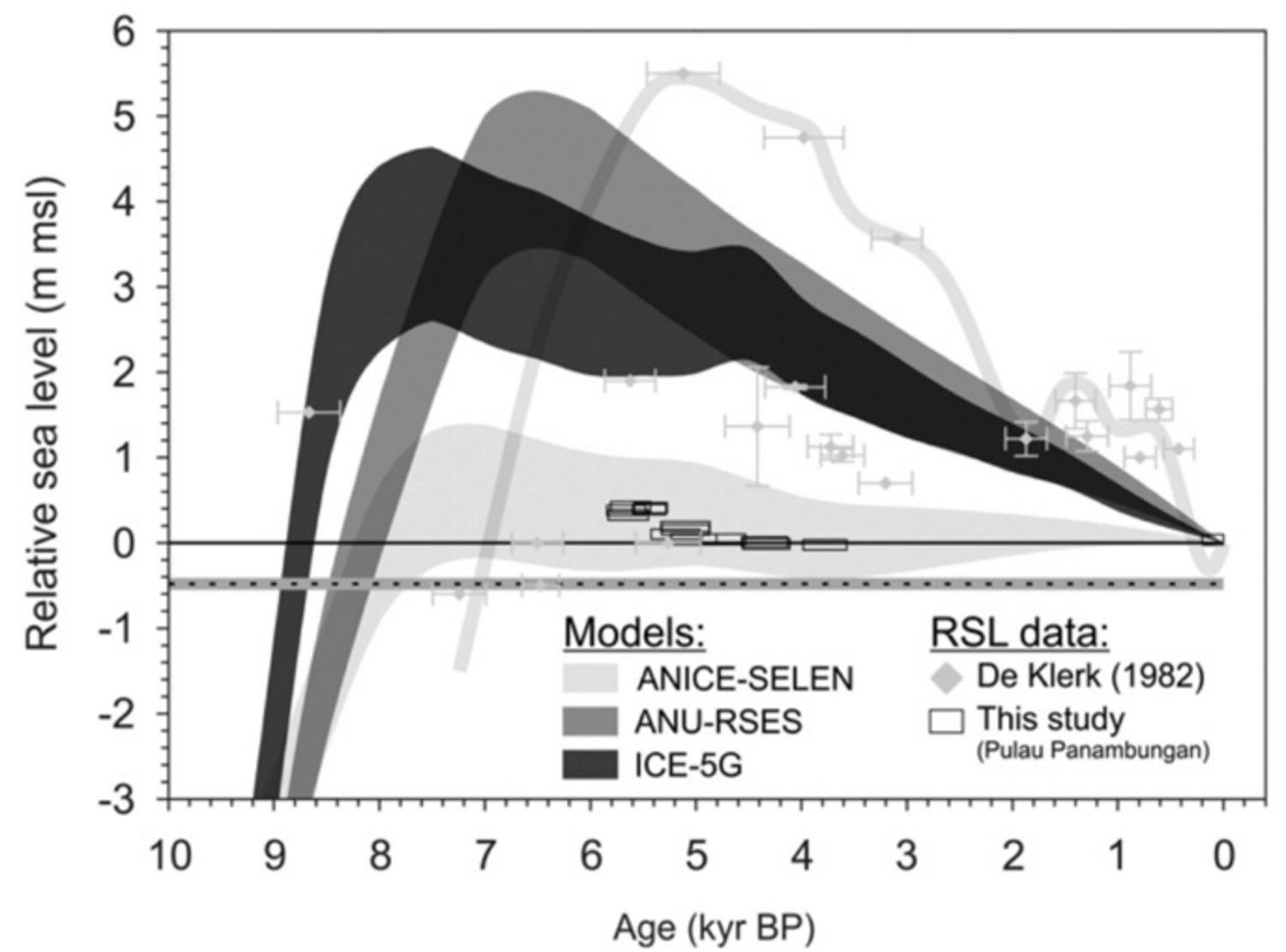
This project aims to investigate Holocene relative sea-level (RSL) changes in South East Asia. We aim to both evaluate former literature data and produce new sea-level index points in order to reconstruct Holocene sea level histories in the region and compare it with predictions of glacial isostatic adjustment (GIA) in order to derive uplift or subsidence patterns in the area. We focus on an area where relatively little research has been carried out on past sea levels, the Strait of Makassar (see Figure 1 for details). This region includes the Spermonde Archipelago, that is composed by low-lying islands that might prove sensitive to RSL changes.
During this study we will review former datasets and produce new sea level index points following standard procedures (Hijma et al., 2015) that will allow the implementation of datasets from SE Asia into global databases (Khan et al., 2015). Although we will focus mostly on coral microatolls, that are one of the most accurate RSL indicators, we will also adopt other proxies, trying to improve the existing definition of their indicative meaning (e.g. defining where each marker was formed with respect to the paleo sea level).
We will compare existing and newly produced field data with a large set of earth models to represent the GIA effects in the study area, and evaluate processes that might exacerbate current sea level rise problems. Attention will be given to the long-term effect of potential subsidence processes caused by the presence of heavily populated islands of the Spermonde Archipelago.
Towards the end of the project, we aim to analyse our field data and modelling in the framework of Bayesian statistical analyses, aiming to answer the question: What are the most vulnerable regions to future sea-level rise in South East Asia?