SPP SeaLevel is in the field!
The SPP SeaLevel has already been in fieldwork in various locations at the two study regions of the North and Baltic Seas, and the South-East Asia, surveying the natural causes and dynamics of sea level change but also its socio-politico-economic aspects and impact on the threatened coastal societies.


In the South-East Asia study region, the EMERSA project the everyday lived dynamics of regional sea level change (RSLC). Dr. Rapti Siriwardane-de Zoysa (Leibniz Center for Tropical Marine Research) was on ethnographic fieldwork until the end of June along the urban coastlines of Jakarta, Singapore and Manila archipelagic megacities. Together with partners from the Universitas Indonesia, University of Asia & the Pacific, and the National University of Singapore, her four-month fieldwork marked the beginning of the empirical research of EMERSA.
At its core, the project questions how and why particular stocks of traveling knowledge - primarily model policy blueprints, 'best practices' and local experimental solutions - gain traction, are politically legitimized, contextually translated, and are further recirculated by a host of actors such as states, donor organizations, international consultancies, and civil society groups.
While the current fieldwork focuses on social practices across multiple scales, the findings invariably encompass broader historic and political dynamics of coastal transformation (e.g. is/land reclamation and seawall construction), and their contemporary contestations around a host of interrelated themes such as land and water tenure, submerged shorelines, and of “sinking cities”.
In the Indonesia region, another young researcher, Lisa-Michéle Bott (University Köln) also completed earlier last year (August-October 2016) the first field research within the TRANSOCAP project. TRANSOCAP explores the translocal social capital of coastal communities, and their ways of coping with short-term hazards (e.g. cyclones and floods) and adapting to the slowly emerging, less perceivable sea level rise.
This first phase of the fieldwork consisted of qualitative research in Semarang, Java, by conducting 8 Focus-Group-Discussions in cooperation with the Faculty of Geography of the Gadjah Mada University, Yogyakarta, Indonesia, with the aim to obtain an in-depth knowledge about social networks and vulnerabilities of coastal neighbourhoods. Based on these qualitative results, Lisa-Michéle developed a standardized household questionnaire.
This year, during March and April 2017, this quantitative survey (n=950) has been carried out in the coastal urban areas of Semarang (n=350) and Jakarta (n=300), as well as in the coastal rural villages in the districts of Kendal (n=160) and Demak (n=160), Central Java, and currently the statistical analysis of the data is under way.
The next field research of TRANSOCAP is planned for spring 2018 again in Jakarta and Semarang, while an ultimate aim is to also hold a final workshop with local partners and experts, where researchers from TRANSOCAP will present and discuss their empirical results.
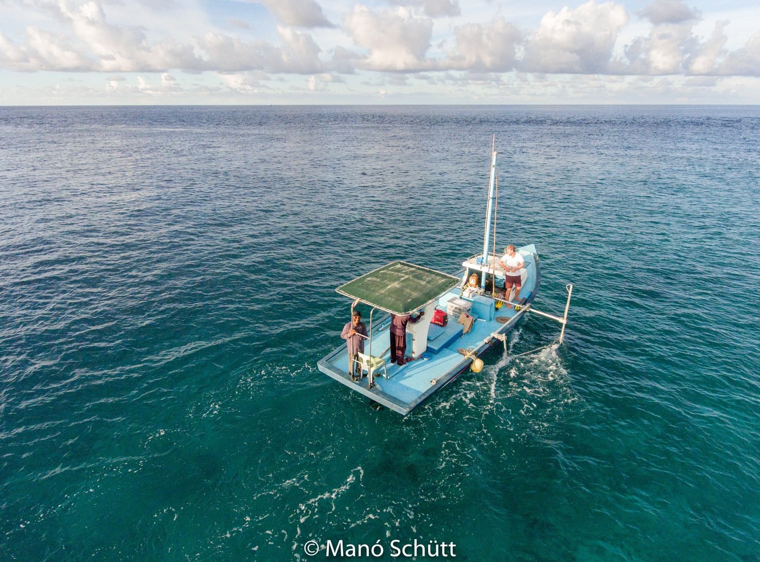
Moreover, the DICES project studies the societal & political challenges & actions to sea level change in Small Island Developing States (SIDS). Recent field surveys included bathymetry & nearshore currents measurements in Maldives (April 2017).
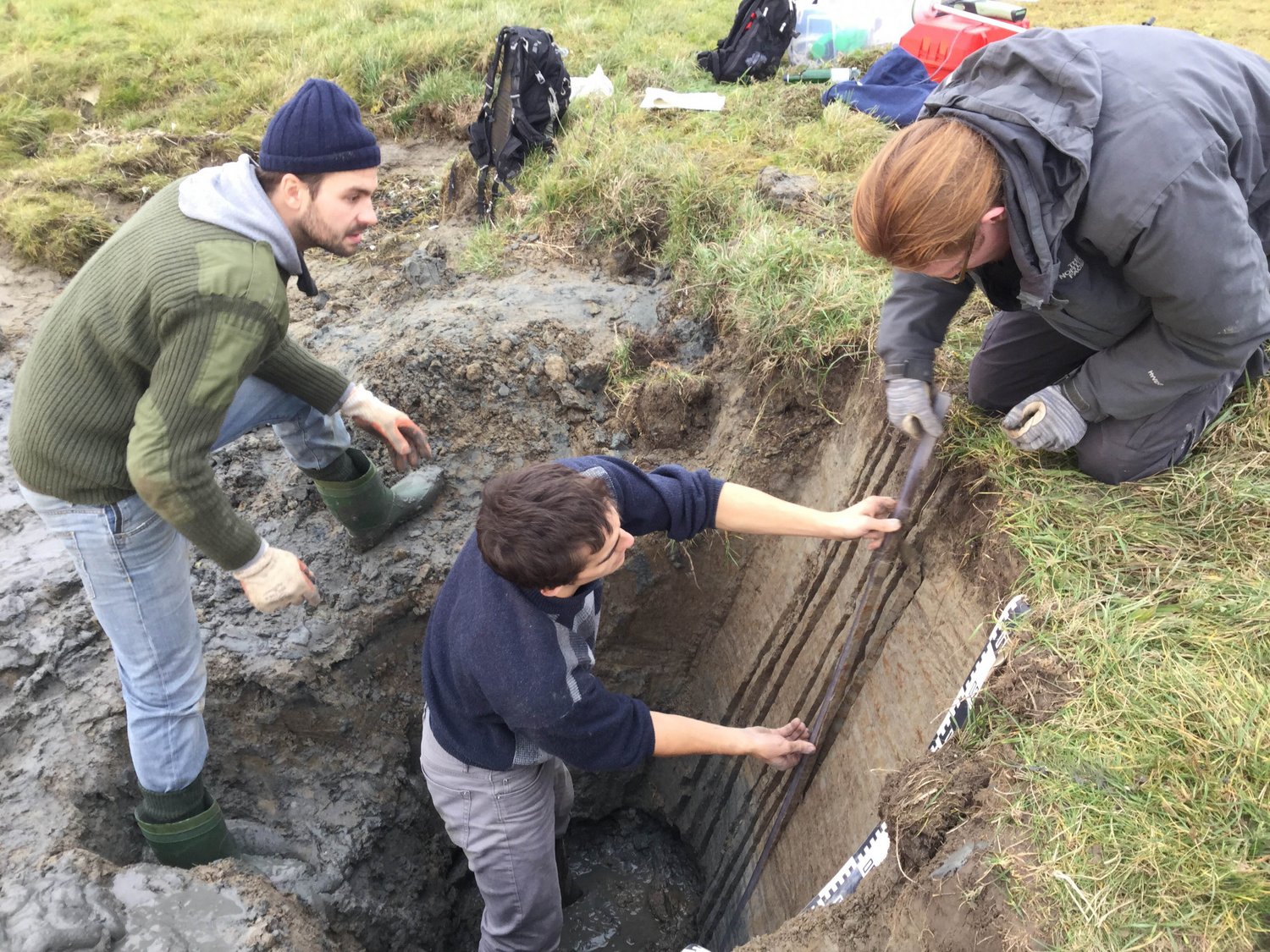
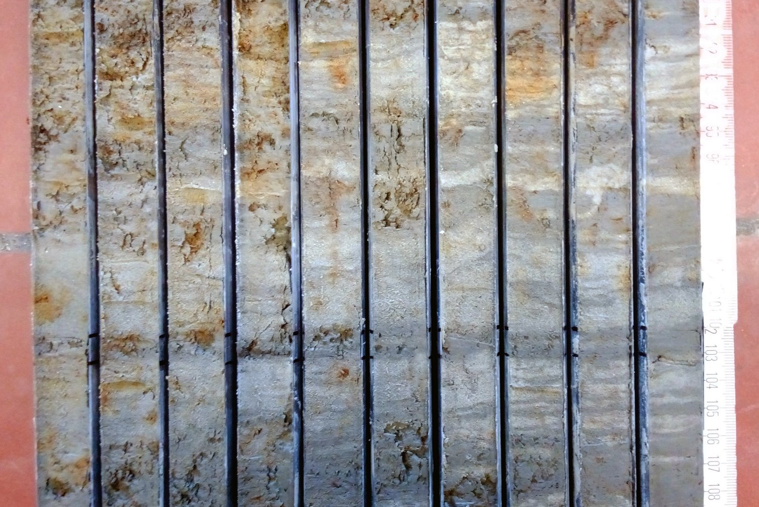
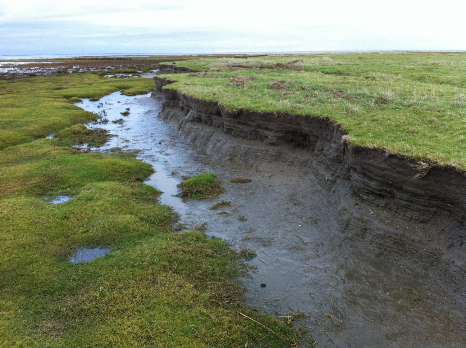
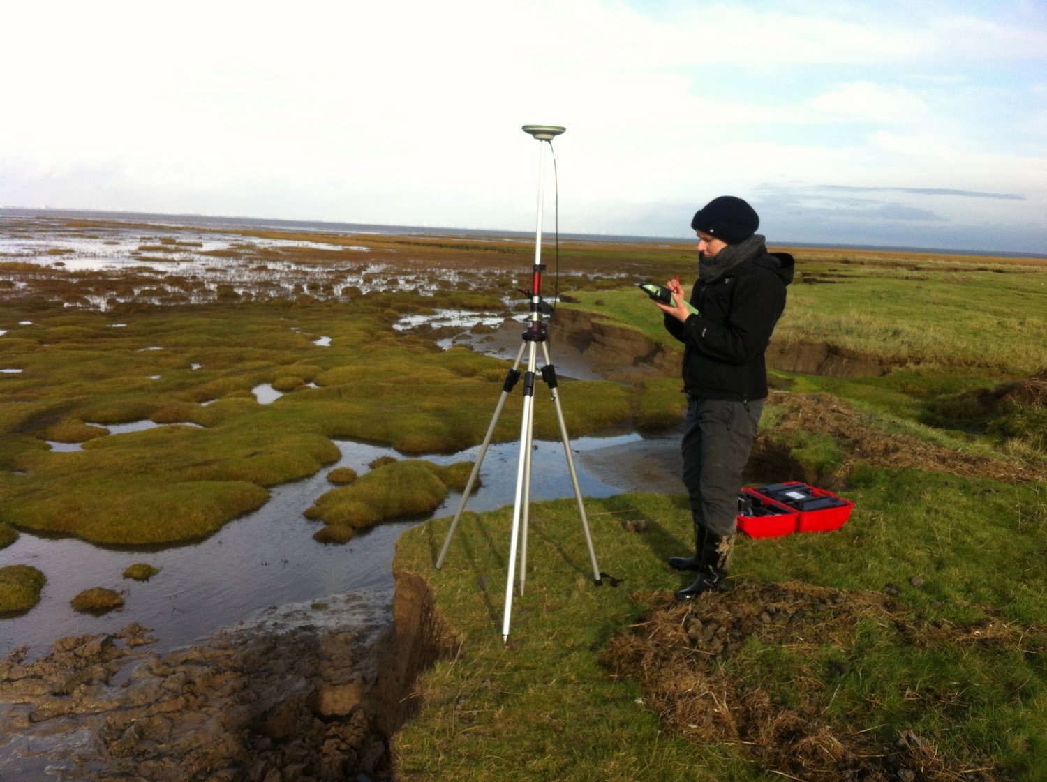
In the North Atlantic region, within the project SEASTORM "Unraveling the signals of sea level and storminess of the past millennium (southern North Sea)", various field campaigns have been conducted to the North Frisian coast to sample sediments from active and fossil salt marshes.
Here, the photos on the right illustrate part of SEASTORM initial fieldwork that took place in sites close to "Friedrichskoog" and the "Eider estuary" ("Eiderwatt & Grüne Insel") during the end of November 2016, in order to sample active salt marsh successions at erosional cuts along the North Frisian coast. One meter of sediment roughly covers 100 year of sedimentation including normal salt marsh sediments and distinct storm surge layers. The established sedimentological and micropaleontological proxy records will be evaluated against historical sea-level and storm records. In a second phase, comparable proxy records will be established for medieval polder sediments extending the time series beyond the historical information. The resulting record of storm surge statistics and relative sea-level changes will be compared to results from climate simulations using a regionally coupled model system.
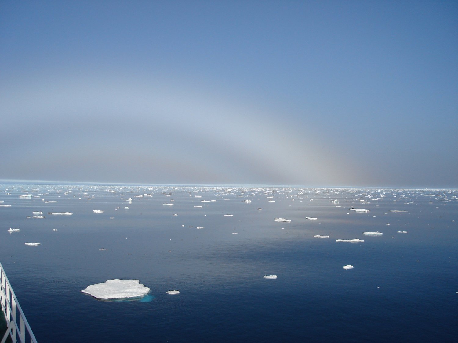
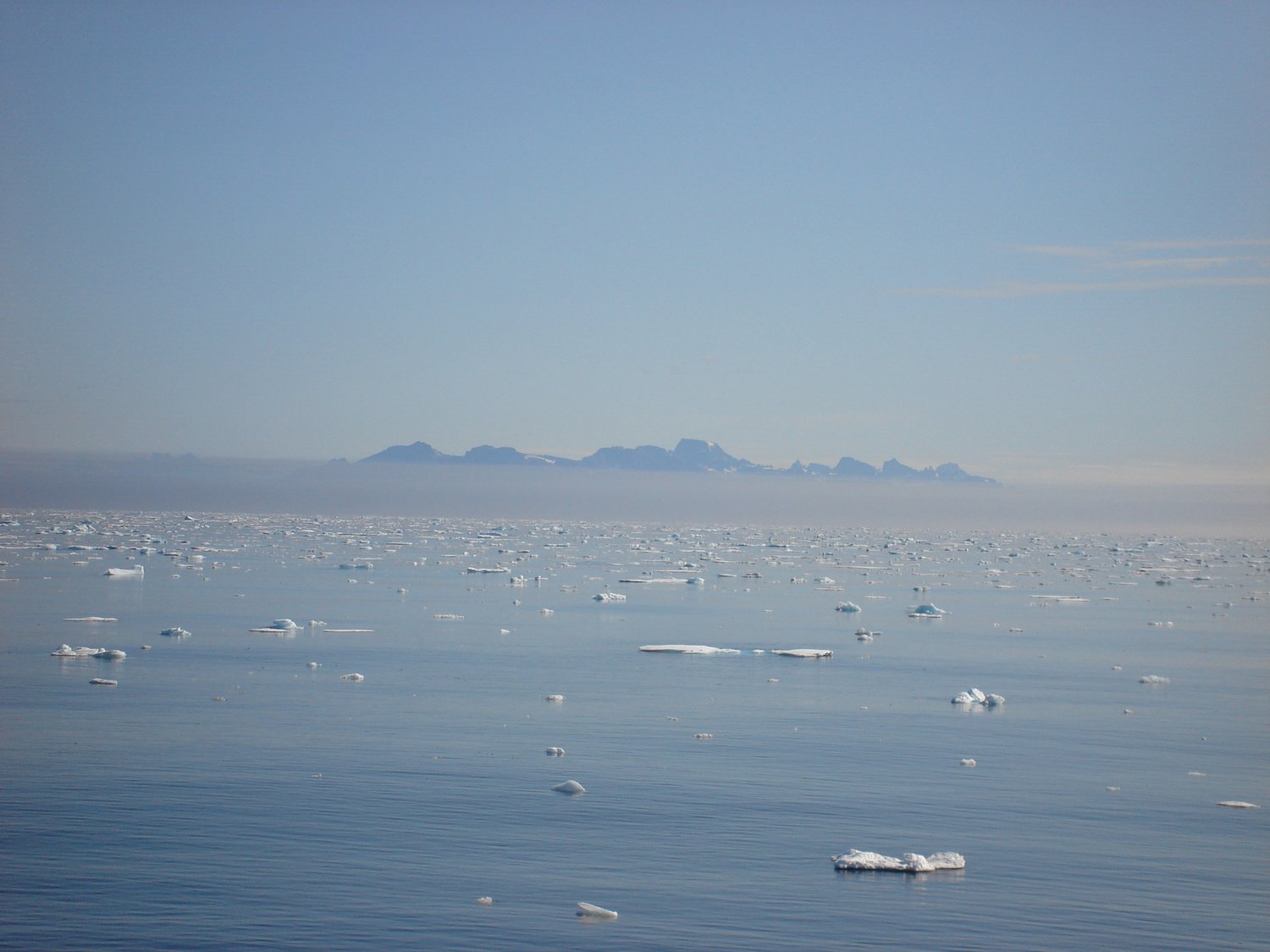
Further north, the Labsea Melt project, as part of their preliminary work in June 2015 used the Maria S. Merian Expedition (MSM43) south of Greenland to sample the Greenland boundary current. Researchers of the Labsea Melt analyzed 160 sea water samples for their content of the stable noble gases helium (He) and neon (Ne). The precise measurement of He and Ne is a powerful tool to calculate the fraction of glacial melt water in the sample and, thus, infer the glacial melting of the Greenland Ice Sheets and the pathways of the melt water in the ocean.
In summer 2016, Labsea Melt researchers participated in two research cruises, i.e. the Maria S. Merian expedition (MSM56, 2.7.2016-25.7.2016) and a Polarstern expedition (PS100, 19.7.2016-9.9.2016). During the first one, they received 75 seawater samples from Spitzbergen and east Greenland fjords, two important sources for melt water from glaciers into the ocean (namely Kongsfjorden in west Spitzbergen, and Scoresby Sund in southeast Greenland). The Polarstern expedition (PS100, 19.7.2016-9.9.2016), led them to the 79°-North-Glacier (79NG) in northeast Greenland. The 79NG is one of the major contributors of glacial melt water to the ocean, and it is known to have increased melting due to significant warming of the ambient ocean waters. About 700 seawater samples for measurement of He and Ne were taken, including the first samples in very close distance (within a few 100 meter distance) to this hardly accessible glacier.The samples are currently analyzed and will be finished within the next months.
In June 2017, researchers from Labsea Melt are participating in another Maria S. Merian cruise (MSM65, 26.6.2017-18.7.2017), during which 170 seawater samples are planned near the southwestern coast of Greenland, namely in the Nuukfjord and in the Disko Bay and Vaigat as well as on transects in-between.
Planned cruise tracks and working areas of MERIAN cruise MSM65. From Oliver Zielinski (Chief Scientist), University of Oldenburg.